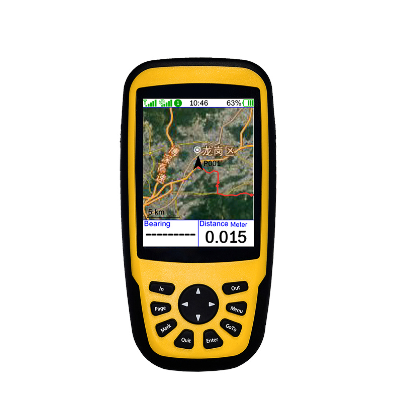
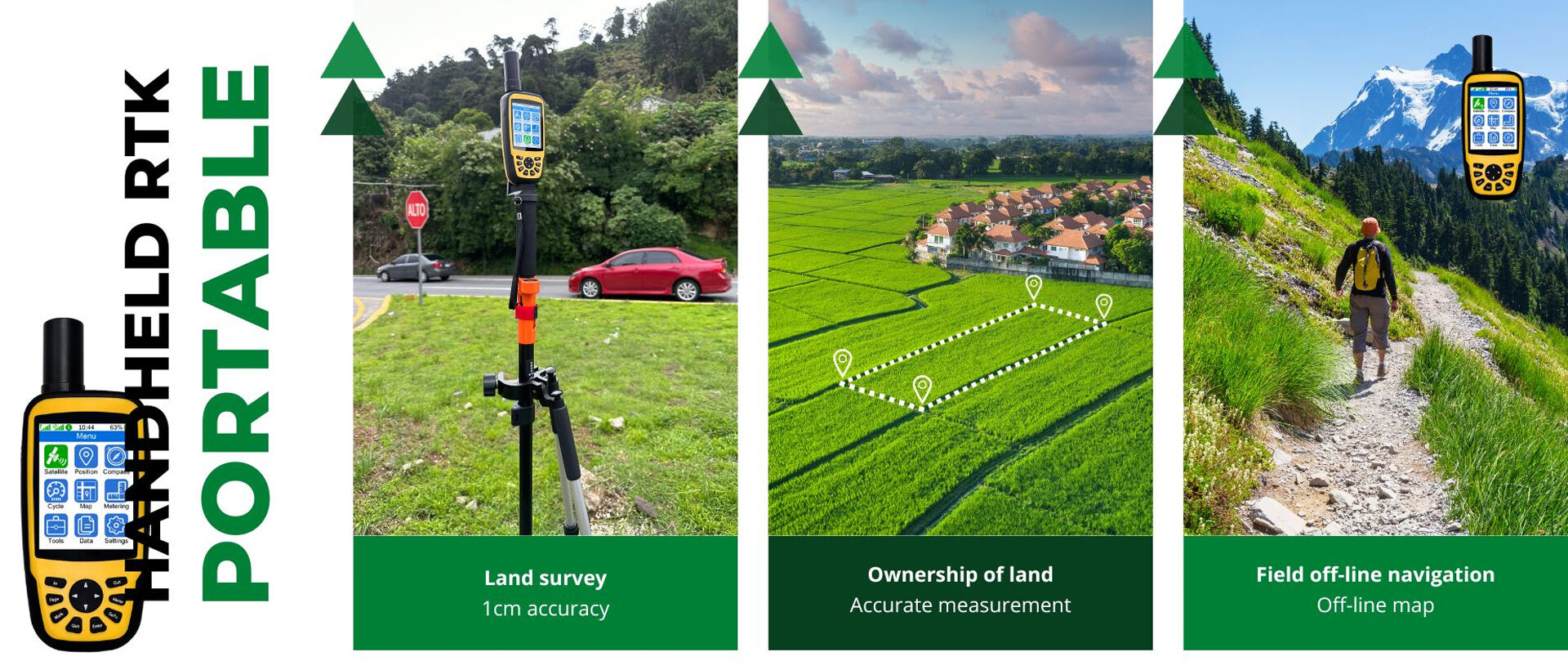
Maskura’s Real-Time Dynamic RTK systems offer centimeter-level precision for agriculture, surveying, and construction, enhancing field accuracy and efficiency
Explore how GNSS technology revolutionizes modern land management, enhancing accuracy in urban planning and precision agriculture. Discover its pivotal role in smart city development and sustainable resource management.

Explore RTK GNSS technology's impact on precision agriculture, enhancing accuracy and efficiency in planting, soil management, and machinery guidance with centimeter-level precision.
Discover the benefits and functionalities of RTK GPS technology for achieving centimeter-level accuracy in location data. Explore topics on receptor-base station synergy, multi-band support, accuracy requirements, system compatibility, and durability factors in various environments and industries.

Explore how RTK GNSS technology revolutionizes land surveying with real-time kinematic accuracy, overcoming traditional methods, and enhancing projects with precision data and reduced costs.
Discover how RTK GPS antennas offer centimeter-level precision through advanced signal processing and dual-frequency designs, transforming agriculture and surveying with real-time kinematic positioning.
Explore the transformative role of agricultural machinery in modern farming, focusing on mechanized power for large-scale operations, precision technologies like RTK GPS, IoT integration, and sustainability gains. Learn about the impact of government policies and the solutions to overcome barriers in machinery adoption.

Discover the precision and evolution of GNSS land surveying through core principles, the role of RTK technology, achieving centimeter-level accuracy, and advantages over traditional methods. Learn how to overcome challenges in GNSS surveying for reliable data collection.
Learn how field navigation systems, RTK GPS, and precision measurement tools are revolutionizing traditional farming, optimizing resources, and reducing environmental impact in modern agriculture.


 EN
EN AR
AR NL
NL FR
FR DE
DE HI
HI IT
IT JA
JA KO
KO PT
PT RO
RO RU
RU ES
ES SV
SV TL
TL IW
IW ID
ID VI
VI SQ
SQ TH
TH TR
TR MS
MS IS
IS HY
HY UR
UR BN
BN MN
MN