Achieving centimeter-level accuracy with RTK GPS technology requires a deep understanding of RTK correction signals. These signals, transmitted from a base station to a moving receiver, play a crucial role in enhancing the positioning accuracy of GPS systems. By processing real-time data, RTK drastically improves GPS accuracy, reducing errors to within centimeters. For instance, phase measurements from satellite signals are used to minimize positioning inaccuracies, making RTK vastly superior to standard GPS. A study has shown that RTK can improve accuracy by over 90% in agricultural applications, revolutionizing precision farming techniques.
The reference station is another key component in this setup, located precisely within a geographical area, which ensures the reliability of corrections. This station knows its exact position and calculates error factors affecting GPS accuracy, like atmospheric interference. By transmitting these corrections, RTK helps various sectors achieve pinpoint accuracy, which is essential for modern agricultural machinery and autonomous systems. This system's robust framework marks a significant advancement over traditional GPS methodologies.
Dual-frequency antennas are ingeniously designed to improve signal reception through the simultaneous reception of two different frequencies. This feature is essential in mitigating atmospheric interference, thereby ensuring greater signal reliability. Particularly in areas with variable environmental conditions, dual-frequency antennas outperform their single-frequency counterparts. For example, statistics have demonstrated up to a 50% improvement in accuracy and reliability in navigating complex agricultural landscapes with dual-frequency antennas.
The integration of advanced materials in antenna construction further boosts reception quality and durability. These antennas find practical applications in numerous fields, enhancing vehicle navigation and boosting agricultural efficiency. In agricultural machinery, for instance, they facilitate precision plowing, planting, and harvesting by ensuring accurate field positioning. Thus, dual-frequency antennas are not merely a leap in RTK technology but pivotal in honing the precision of various geospatial technologies, making them indispensable in fields requiring high levels of accuracy.
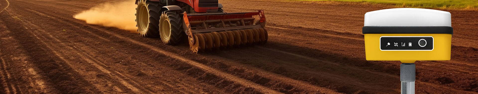
RTK GPS antennas are revolutionizing precision farming by optimizing the use of inputs such as fertilizers, pesticides, and water. This technology enables farmers to apply these resources precisely where needed, minimizing waste and environmental impact while significantly increasing crop yields. Statistics from agronomy studies reveal that farms utilizing RTK GPS have seen yield improvements as high as 20%. One of the critical applications of RTK technology in agriculture is in tractors and harvesters, where it facilitates automated steering and responsive adjustments, ensuring precise navigation even in challenging terrains. Regions renowned for rice and corn cultivation have reported substantial benefits, demonstrating the transformative potential of RTK GPS. As we look to the future of agriculture, RTK technology is poised to enhance autonomous farming equipment, paving the way for more sustainable and efficient farming practices.
In land surveying, RTK technology dramatically enhances efficiency by providing real-time corrections that ensure centimeter-level accuracy in location data. This increased accuracy is invaluable in civil engineering projects such as infrastructure development, where precise mapping is crucial for planning and execution. Industry-standard specifications for RTK survey equipment show significant improvements in both time and cost savings, decreasing surveying duration by up to 50% compared to traditional methods. Case studies demonstrate successful RTK mapping projects, such as the development of new urban spaces and environmental research sites, underscoring the practical benefits of RTK surveying. Furthermore, RTK's application extends beyond traditional boundaries into industries like construction and environmental research, highlighting its widespread importance and versatility in modern-day operations.
RTK GPS systems bring an unmatched level of precision to positioning technologies, differentiating themselves significantly from standard GPS. While traditional GPS offers sub-meter accuracy, the real game-changer is RTK's centimeter-level precision. According to GPS performance studies, this difference can mean the world in applications where exact location data is crucial. For instance, in land surveying or autonomous vehicle navigation, even a few centimeters can make a substantial impact. Moreover, standard GPS often falls short due to inherent errors such as signal multipath, atmospheric delays, and satellite geometry, which affects its reliability. In contrast, RTK GPS manages these errors through real-time corrections, thus providing highly accurate data. Industries like construction and agriculture are rapidly adopting RTK technology to benefit from its precision and ensure better resource utilization and operational efficiency.
RTK positioning systems excel not only in precision but also in their real-time capabilities, immensely benefiting operational tasks. They contribute to productivity by offering immediate feedback, which is invaluable in sectors ranging from precision agriculture to high-stakes construction projects. For example, the real-time nature of RTK allows for dynamic adjustments in machinery operations, leading to reduced downtime and improved productivity. Reports from industry specialists indicate that RTK systems endure even adverse weather conditions, maintaining reliability and ensuring consistent output. Professionals who have switched to RTK systems often testify to enhanced decision-making abilities and operational efficacy. Looking forward, the evolution of RTK technology is likely to set the stage for groundbreaking advancements in positioning applications, cementing its role as a cornerstone in precision-demanding fields.
Quality RTK receptors play a critical role in ensuring accurate data transmission and reliable positioning. These receptors incorporate advanced technological components designed to enhance precision in RTK GPS systems, which are pivotal for applications requiring centimeter-level accuracy. In contrast, poor-quality receptors can significantly increase error rates, making it essential to invest in high-quality hardware. For example, according to studies, low-grade receptors might introduce errors exceeding acceptable thresholds, affecting overall system performance. Key features of top-performing RTK receptors include compatibility with multiple satellite constellations such as GPS, GLONASS, Galileo, and BeiDou, as seen in the Septentrio AsteRx SB3 series. These advancements not only boost signal reception but also enhance compatibility with various surveying and agricultural machinery. Regular maintenance and calibration are vital to prolong receptor life and performance, ensuring optimal functionality over time.

Signal interference poses a significant challenge in RTK systems, particularly in environments with dense urban structures or natural obstacles. These interferences can disrupt signal reception, impacting the accuracy of RTK positioning. Common sources include high-rise buildings, trees, and other barriers that obstruct line-of-sight communication. To mitigate these challenges, employing strategic antenna placement and advanced filtering techniques is essential. These methods optimize signal clarity and reduce interference susceptibility, which can be supported by statistics demonstrating performance improvements in varied settings. Insights from geospatial technology experts highlight the importance of adopting best practices, like utilizing multi-constellation GNSS systems, as they offer refined solutions to interference issues. By embracing these emerging technologies, future RTK positioning systems can achieve more resilient and dependable performance in challenging environments.


 EN
EN AR
AR NL
NL FR
FR DE
DE HI
HI IT
IT JA
JA KO
KO PT
PT RO
RO RU
RU ES
ES SV
SV TL
TL IW
IW ID
ID VI
VI SQ
SQ TH
TH TR
TR MS
MS IS
IS HY
HY UR
UR BN
BN MN
MN