Cutting edge RTK GNSS systems by Maskura Tech are the trend setters in this generation of land surveying technology. For unparalleled precision and reliability, our RTK GNSS solutions redefine accuracy in geospatial data collection and mapping.
Introduction:
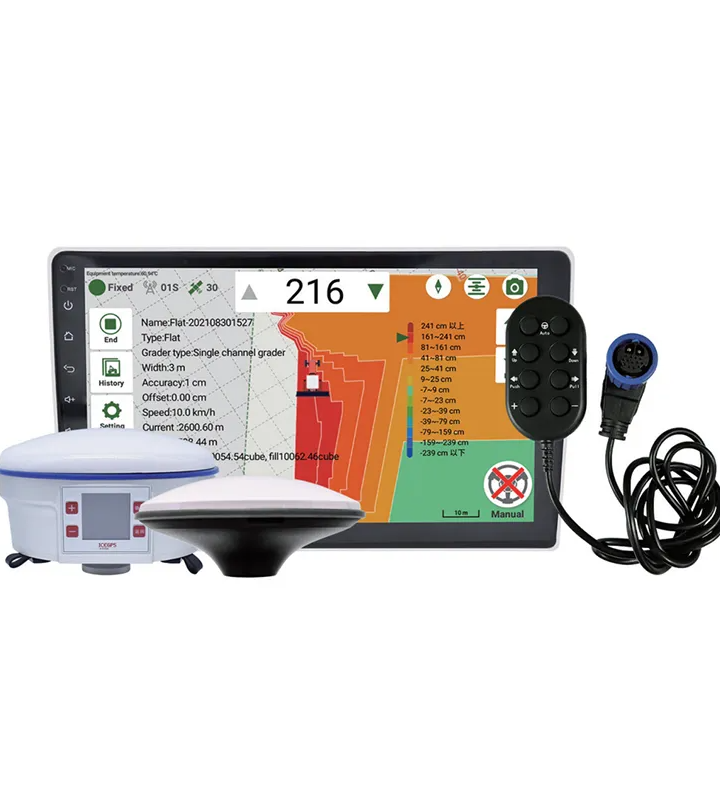
At Maskura Tech, we specialize in offering advanced RTK GNSS systems that meet the high demands professionals have to deal with as far as engineering is concerned. Our setups therefore utilize both Real-Time Kinematic (RTK) technology together with Global Navigation satellite Systems (GNSS) hence making them more precise by enabling centimeter level positioning data. Our RTK GNSS systems for land surveying, construction layout or precision agriculture provide you confidence and efficiency that enable you to produce topmost quality results relative to your peers.
Key Features:
Centimeter-Level Accuracy: This means our RTK GNSS systems have been made very precise and can simply give you positioning data within a centimeter level.
Real-Time Data Transmission: Required for operatives working dynamically on-site conditions at all times.
Robust Performance: Manufactured such that they can handle tough environmental situations thereby ensuring their dependability under any weather condition or terrain.
User-Friendly Interface: Operation is easy due to intuitive software interfaces which leads to reduced training time and improved productivity.
Versatile Applications: Including but not limited to; data capture for land surveys, asset management, mapping among others.
Applications:
Our customers come from various industries who trust our range of RTK GNSS systems:
Surveying and Mapping: They include capturing of exact details of features along the ground surface including boundaries
Construction: Where accurate site layouts ensure that the project aligns with design plans
Agriculture: With accurate guidance on seeding, spraying, harvesting etc., one can optimize field operations for better results.
Conclusion:
When it comes to collecting geospatial information as well as carrying out analysis of the same with accuracy and efficiency, you need to invest in Maskura Tech’s RTK GNSS systems. They provide land surveying solutions developed to serve 21st century industries.
Contact Us:
To find out more about how Maskura Tech can add value to your projects through our range of RTK GNSS systems, please follow this link which will redirect you to Maskura Tech.
Maskura Technology’s RTK GNSS systems facilitate precision agriculture practices by providing accurate positioning for planting, fertilizing, and harvesting operations. Our systems enhance resource efficiency and crop yields. B2B customers in agriculture rely on Maskura for scalable and dependable RTK GNSS technology.
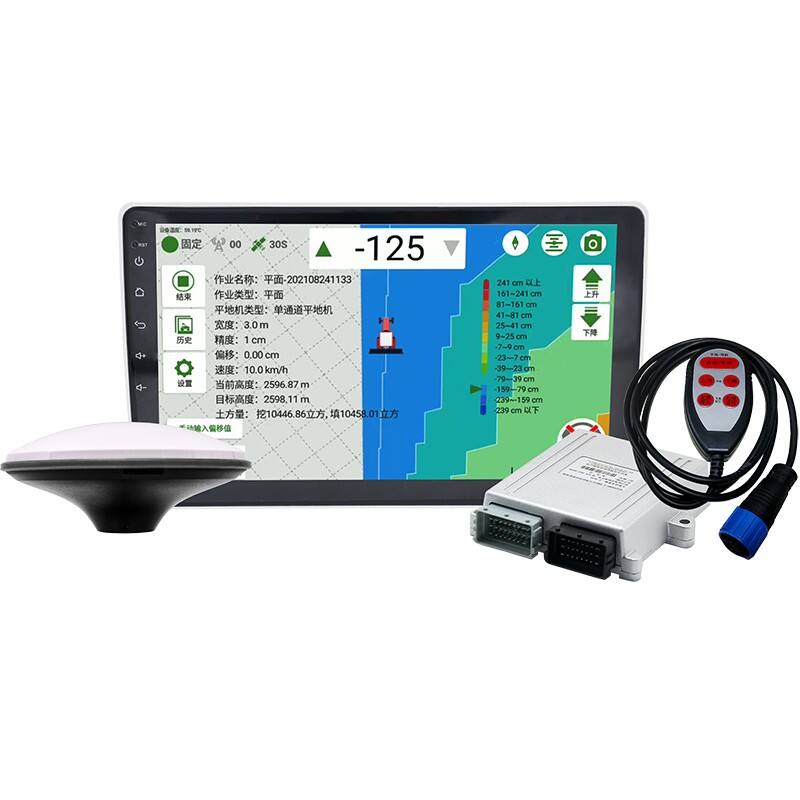
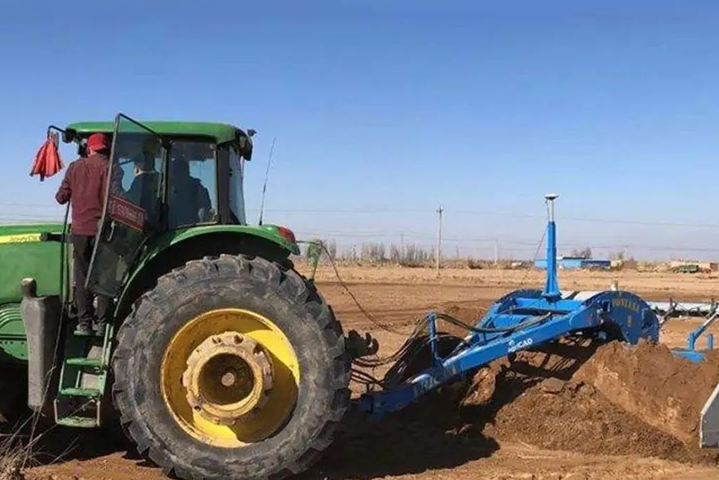
Effective construction management requires precise location data. Maskura Technology’s RTK GNSS systems deliver reliable real-time positioning to support site layout, machine control, and project monitoring. B2B clients trust Maskura’s solutions to increase productivity and reduce costly errors in construction operations.
Maskura Technology’s RTK GNSS systems provide superior accuracy critical to land surveying and mapping projects. Our systems enable real-time corrections that significantly reduce positioning errors. B2B partners benefit from Maskura’s advanced technology to streamline workflows and improve data reliability in complex survey environments.
Maskura Technology offers customizable RTK GNSS system configurations to meet diverse client needs. From hardware components to software integration, our solutions adapt to specific project requirements. B2B clients benefit from Maskura’s flexible approach that enhances precision and operational compatibility.
Shenzhen Maskura Technology, a renowned manufacturer of Hi-tech GNSS surveying equipment, has been at the forefront of innovation since its establishment in 2011. Specializing in a diverse range of products including RTK receivers, antennas, sophisticated software, land levelers, and autopilot systems, the company offers dependable and high-quality solutions to customers across the globe. With a focus on precision and accuracy, Maskura Technology's surveying equipment is trusted by professionals in various industries, ensuring accurate measurements and seamless operations. The company's commitment to excellence and continuous innovation has made it a leading choice for those seeking advanced surveying solutions.
Delivering cutting-edge technological advancements for diverse industries.
Ensuring superior product quality with rigorous testing and precision engineering.
Providing tailored solutions and excellent support to meet unique client needs.
Committed to meeting client needs with tailored solutions and exceptional support.
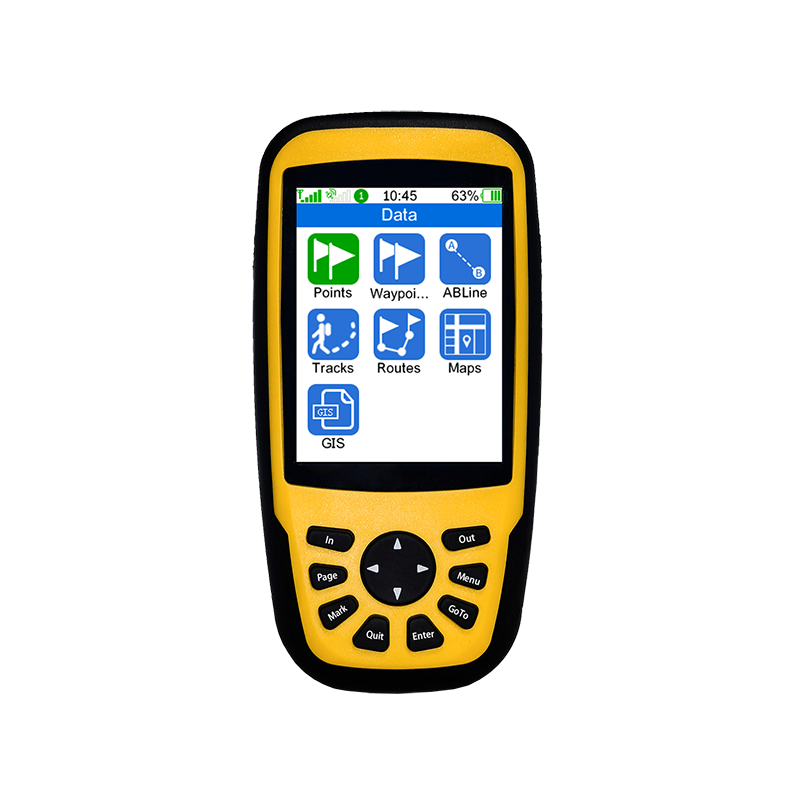
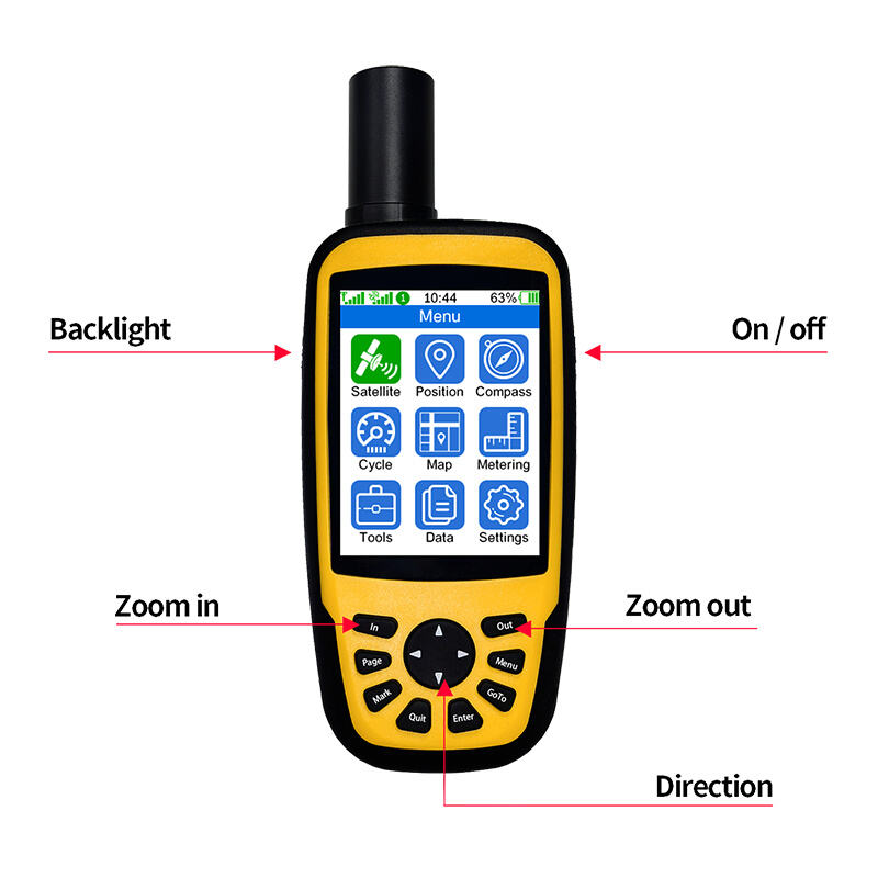
An RTK GNSS (Real-Time Kinematic Global Navigation Satellite System) system is a high-precision satellite navigation technology used in surveying and mapping. It provides real-time, centimeter-level accuracy by using carrier phase measurements of GPS signals. This allows for precise positioning of points on the Earth's surface, crucial for applications requiring accuracy such as construction, agriculture, and geodesy.
RTK GNSS systems work by comparing phase differences between a base station and a rover receiver. The base station calculates its position using known coordinates and transmits correction data to the rover. The rover, equipped with the same GNSS receiver technology, uses these corrections to refine its own position in real-time. This method compensates for atmospheric and satellite signal errors, achieving highly accurate positioning.
The primary advantages include centimeter-level accuracy in real-time, enhanced productivity due to reduced surveying time, and improved efficiency in operations such as land surveying, construction layout, and precision agriculture. RTK GNSS systems also offer the flexibility of working in diverse environmental conditions and terrain types, making them versatile tools for geospatial applications.
RTK GNSS systems find widespread use in industries requiring precise location data. These include construction for site preparation and layout, agriculture for precision farming and crop management, infrastructure development for accurate positioning of utilities and transportation networks, as well as environmental monitoring and resource management. Their application ensures reliable and accurate spatial data collection, crucial for informed decision-making in various sectors.


 EN
EN AR
AR NL
NL FR
FR DE
DE HI
HI IT
IT JA
JA KO
KO PT
PT RO
RO RU
RU ES
ES SV
SV TL
TL IW
IW ID
ID VI
VI SQ
SQ TH
TH TR
TR MS
MS IS
IS HY
HY UR
UR BN
BN MN
MN