The game has changed completely in terms of accuracy and efficiency, within the world of advanced surveying and geospatial measurements as a result of RTK (Real-Time Kinematic) technology. In this regard, we have designed our RTK survey equipment at Maskura Tech to be accurate and dependable.
Unprecedented Accuracy through Cutting-Edge Technology
Our RTK survey equipment uses the most recent advances in satellite navigation as well as real-time data processing to achieve centimeter-level accuracy. This level of precision is important for various applications e.g., land surveying, construction works, agriculture or environmental monitoring. By using this brand’s products, you can be sure that your measurements will always be on target saving on cost due to errors made during work.
Ease-of-use meets rugged construction
We are aware that surveyors find themselves working under every kind of condition so we have ensured that our product is both tough enough to withstand any harsh condition while being easy enough for use. These units come with designs that are strong thus enabling them to survive tough handling or even extreme weather conditions without compromising their performance consistency because anything can happen! Staff are able to quickly set up & operate this device even when they are working under demanding field conditions thanks to an intuitive interface and ergonomic features.
Data Integration That Is Seamless And Connectivity
Some options provided within our range include Bluetooth and Wi-Fi cellular capability for straightforward communication between base stations/control centres with field devices. This feature enables live data transmission plus integration with different kinds of software packages used together with GIS (Geographic Information System) streamlining workflow efficiency among team members involved in different phases across large projects sites.
Multiple Applications
Such systems from Maskura Tech have been purposely designed with flexibility in mind thus they may cover a wide range surveys; topographical mapping, boundary demarcation etc when there is requirement for high levels of accuracy combined with time savings. Moreover, within precision agriculture accurate positioning becomes of more importance meaning that planting may require seedlings to be closer or further away from one another depending on soil fertility levels while irrigation would involve different water distribution patterns for different crops.
Training and Support
We believe that a sale should not mean the end of a transaction. Our support team can help you with setting up and troubleshooting your RTK survey equipment while training programs have been developed to equip users with in-depth knowledge about this technology so that they can exploit it fully.
Conclusion
When it comes down to surveying there is no better way than using RTK (Real-Time Kinematic) systems which guarantee accuracy plus efficiency beyond any doubt. Therefore, over the years Maskura Tech’s RTK survey equipment has grown popular among professionals in various industries because of its reliability accompanied by innovative features as guaranteed. Trust us with your demands as we have products coming with assurance of quality such as software updates versus post-sale services among others for each role along their life-cycle satisfying customers looking for flawlessness in projects done at different stages throughout them just visit Maskura tech today!
Shenzhen Maskura Technology, a renowned manufacturer of Hi-tech GNSS surveying equipment, has been at the forefront of innovation since its establishment in 2011. Specializing in a diverse range of products including RTK receivers, antennas, sophisticated software, land levelers, and autopilot systems, the company offers dependable and high-quality solutions to customers across the globe. With a focus on precision and accuracy, Maskura Technology's surveying equipment is trusted by professionals in various industries, ensuring accurate measurements and seamless operations. The company's commitment to excellence and continuous innovation has made it a leading choice for those seeking advanced surveying solutions.
Delivering cutting-edge technological advancements for diverse industries.
Ensuring superior product quality with rigorous testing and precision engineering.
Providing tailored solutions and excellent support to meet unique client needs.
Committed to meeting client needs with tailored solutions and exceptional support.
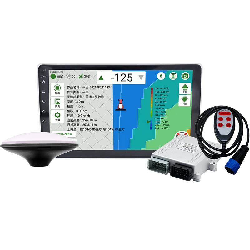
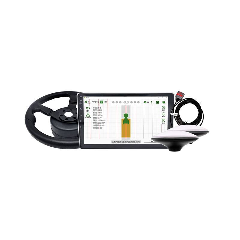
RTK (Real-Time Kinematic) surveying equipment is advanced technology used in land surveying and geodesy to provide highly accurate location data. This equipment utilizes the signals from Global Navigation Satellite Systems (GNSS) to achieve centimeter-level precision in positioning. RTK surveying systems typically consist of a base station and one or more rovers.
The base station is placed at a known location and collects GNSS data, which it then transmits to the rovers in real-time. The rovers are mobile units that receive both the base station data and direct GNSS signals from satellites. By comparing the two sets of data, the system can correct for errors caused by atmospheric conditions, satellite orbits, and other factors, thereby significantly improving positional accuracy.
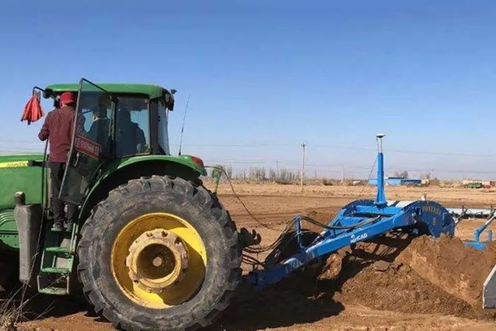
RTK technology is widely used in various applications, including construction, agriculture, and mapping, where precise measurements are critical. In construction, RTK surveying equipment helps in site preparation and monitoring. In agriculture, it is used for precision farming, enabling the accurate placement of seeds and fertilizers. In mapping, RTK systems provide detailed and accurate topographical data.
Overall, RTK surveying equipment is essential for tasks requiring high precision and reliability in location data, making it a vital tool in modern surveying practices.


 EN
EN AR
AR NL
NL FR
FR DE
DE HI
HI IT
IT JA
JA KO
KO PT
PT RO
RO RU
RU ES
ES SV
SV TL
TL IW
IW ID
ID VI
VI SQ
SQ TH
TH TR
TR MS
MS IS
IS HY
HY UR
UR BN
BN MN
MN