Get in touch

RTK GPS: Revolutionizing Land Surveying

RTK GPS: Revolutionizing Land Surveying

Advanced RTK GPS systems enhance navigation accuracy, making them essential for modern agriculture, construction, and geospatial data collection.

Get A Quote
RTK GPS Technology and Precision Farming

RTK GPS Technology and Precision Farming

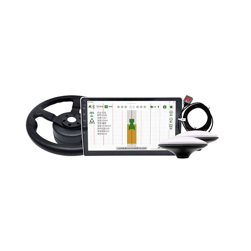
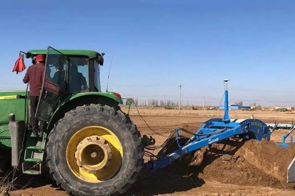
In precision farming, RTK GPS technology has become a very important tool for high accuracy in field operations. Tasks like planting, fertilizing or harvesting can be done with an exceptional degree of accuracy by farmers due to centimeter level precision this technology offers. This precise way of doing things ensures that the planting of seeds and use of fertilizers is just right leading to increased crop yield without wastage of resources. Furthermore, automated machinery is given direction to move across fields using RTK GPS systems which enhance productivity as well as efficiency in modern agriculture.

High-Accuracy Navigation with RTK GPS in Modern Agriculture

High-Accuracy Navigation with RTK GPS in Modern Agriculture

Present-day farming cannot do without RTK GPS systems for high-precision navigation and positioning. These systems give real-time corrections of the GPS signals to help farmers have accurate field operations beginning from planting, spraying and watering. This precision ensures that inputs like seeds, fertilizers, and water are applied exactly where needed, reducing waste and improving crop yields. RTK GPS also supports the use of autonomous farming machinery which can operate with minimal human intervention thus enhancing efficiency and productivity on the farm.

Getting to Centimeter-Level Accuracy with RTK GPS

Getting to Centimeter-Level Accuracy with RTK GPS

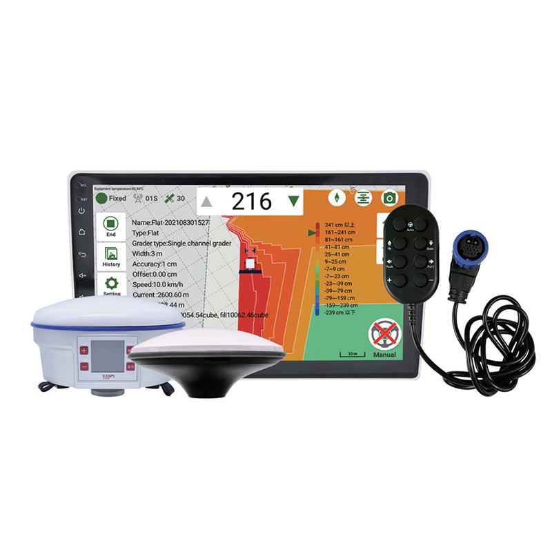
One of the main benefits of RTK GPS is that it offers centimeter-level accuracy in terms of positioning and navigation (Mohan, 2011). This level of accuracy is important in many applications including surveying, construction and farming. In surveying for instance, RTK GPS guarantees that the measurements are accurate and consistent hence useful in making detailed maps or planning land use. On the other hand, constructing using this tool makes sure that buildings come up as planned. In farming, agriculture uses this technology to ensure accurate field activities leading to better management decisions and increased crop production.

Boosting Navigation Accuracy Using RTK GPS

Boosting Navigation Accuracy Using RTK GPS

The demand for navigation systems that are highly accurate has seen the adoption of RTK GPS technology become more common. This is essential in situations where accuracy matters most, like with drones, autonomous cars and robots. It corrects standard GPS signals on real time basis to achieve a precision level of up to few centimeters. Exact positioning is important for such tasks as steering automated farm machinery through fields, maneuvering construction equipment within tight areas and carrying out detailed aerial surveys using drones.

We Have The Best Solutions for Your Business

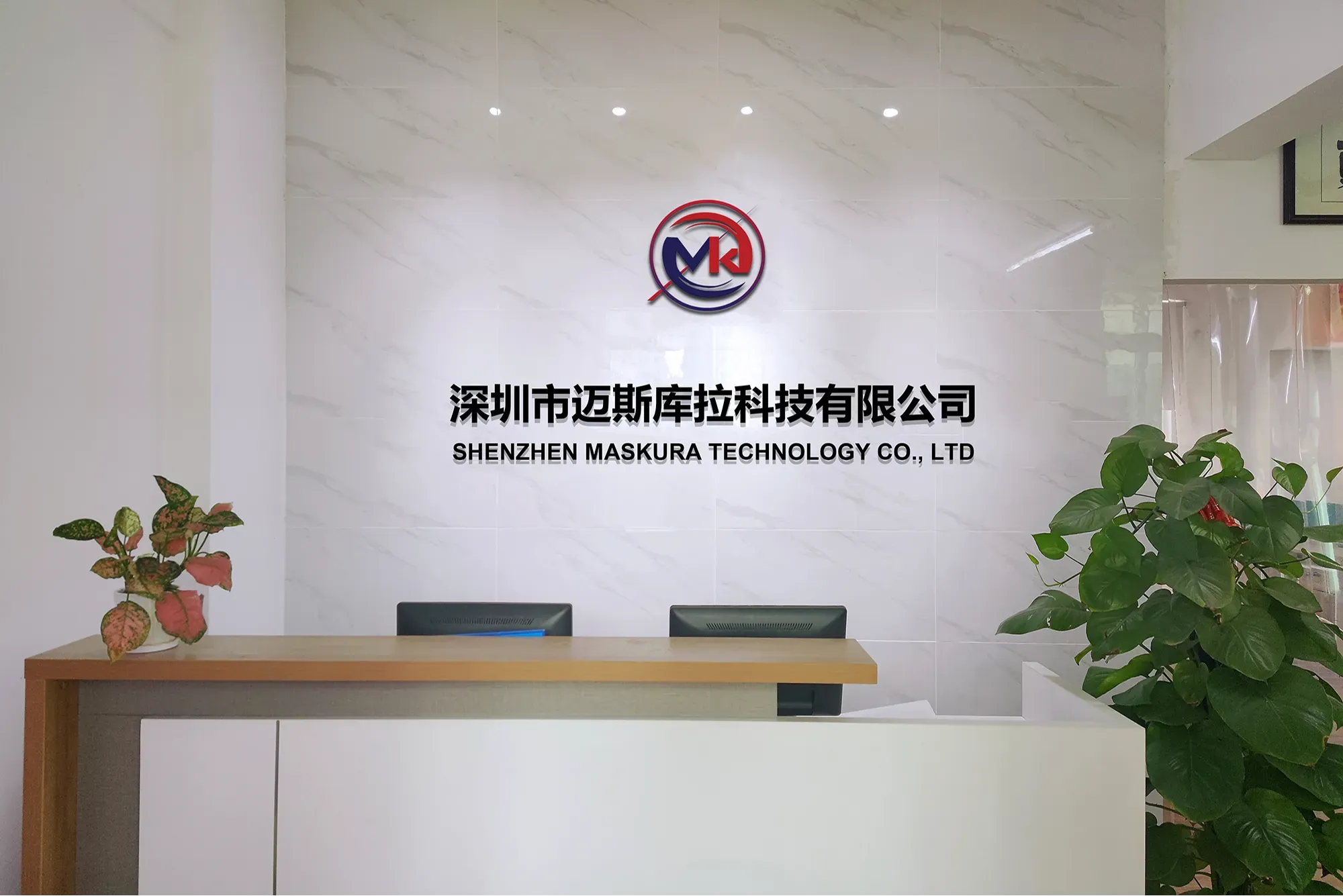
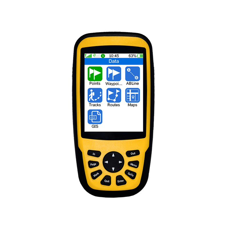
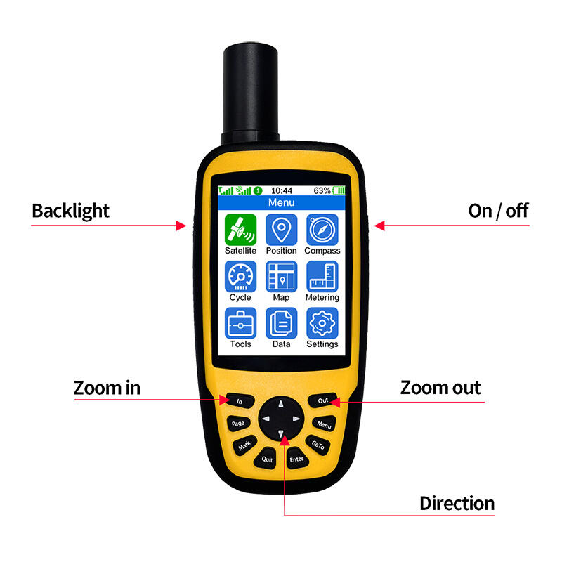
Shenzhen Maskura Technology, a renowned manufacturer of Hi-tech GNSS surveying equipment, has been at the forefront of innovation since its establishment in 2011. Specializing in a diverse range of products including RTK receivers, antennas, sophisticated software, land levelers, and autopilot systems, the company offers dependable and high-quality solutions to customers across the globe. With a focus on precision and accuracy, Maskura Technology's surveying equipment is trusted by professionals in various industries, ensuring accurate measurements and seamless operations. The company's commitment to excellence and continuous innovation has made it a leading choice for those seeking advanced surveying solutions.

Why Choose Maskura

Innovative Technology Solutions

Delivering cutting-edge technological advancements for diverse industries.

High-Quality Standards

Ensuring superior product quality with rigorous testing and precision engineering.

Customer-Centric Approach

Providing tailored solutions and excellent support to meet unique client needs.

Customer-Centric Approach

Committed to meeting client needs with tailored solutions and exceptional support.

USER REVIEWS

What users say about Maskura

As a B2B procurement professional specializing in advanced geospatial solutions, I am delighted to share my experience with the Portable RTK system from Maskura Tech. Our organization has been in search of a reliable, high-precision real-time kinematic (RTK) system that could enhance our surveying and mapping capabilities, and the Portable RTK has exceeded our expectations.

5.0

make

The customer service from Maskura Tech has been outstanding. From the initial inquiry to post-purchase support, their team has been responsive and knowledgeable. They have provided comprehensive training and support, ensuring that we are fully equipped to utilize the device to its full potential.

5.0

clarke

Our experience with the Portable RTK from Maskura Tech has been overwhelmingly positive. It has become an indispensable tool in our geospatial toolkit, enhancing our capabilities and enabling us to deliver superior results to our clients. I highly recommend the Portable RTK to any organization seeking a high-precision, reliable, and cost-effective RTK solution. Maskura Tech has set a new standard in the industry with this exceptional product.

5.0

Laura

Blog

{keyword}:RTK technology leads the innovation and development of surveying and mapping industry

26

Jul

{keyword}:RTK technology leads the innovation and development of surveying and mapping industry

View More
{keyword}:RTK Technology Enables Smart City Construction and Refined Management

26

Jul

{keyword}:RTK Technology Enables Smart City Construction and Refined Management

View More
{keyword}:RTK technology promotes precision agriculture and modernizes agricultural production

26

Jul

{keyword}:RTK technology promotes precision agriculture and modernizes agricultural production

View More

FREQUENTLY ASKED QUESTION

Do You Have Any Question?

What is RTK GPS and how does it work?

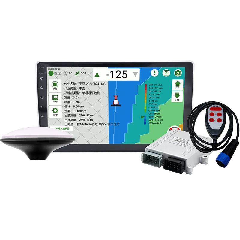
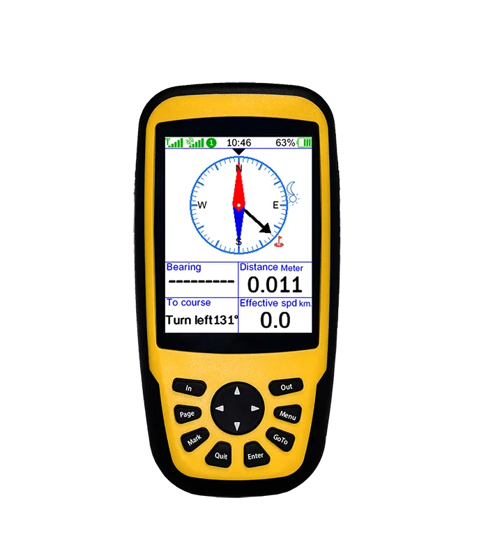
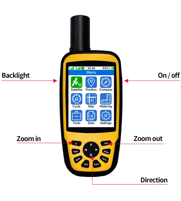
RTK GPS (Real-Time Kinematic Global Positioning System) is a satellite navigation technique used to enhance the precision of position data derived from satellite-based positioning systems. RTK works by utilizing the signal from multiple GPS satellites and a stationary reference station on the ground. The reference station transmits correction data to the GPS receiver in real-time, reducing errors and achieving centimeter-level accuracy. This method corrects for errors such as atmospheric delays and satellite orbit inaccuracies, making RTK GPS essential for applications requiring high precision, such as surveying, agriculture, and autonomous vehicle navigation.

What are the advantages of using RTK GPS in agricultural applications?

RTK GPS offers several advantages in agricultural applications, including:

  1. Enhanced Precision: RTK GPS provides centimeter-level accuracy, allowing for precise planting, fertilizing, and harvesting operations.
  2. Increased Efficiency: Farmers can optimize field operations, reducing overlaps and gaps, leading to efficient use of resources and time.
  3. Cost Savings: By improving precision, farmers can minimize waste of seeds, fertilizers, and pesticides, resulting in cost savings.
  4. Environmental Benefits: Precise application of inputs reduces environmental impact by minimizing runoff and over-application.
  5. Improved Yield: Consistent and accurate field operations contribute to better crop management and higher yields.

What are the limitations of RTK GPS technology?

Despite its high accuracy, RTK GPS technology has several limitations:

  1. Dependency on Signal: RTK GPS requires a clear line of sight to multiple satellites and the reference station, making it less effective in areas with obstructions such as trees, buildings, or rough terrain.
  2. Infrastructure Costs: Establishing and maintaining reference stations can be costly, particularly for large or remote areas.
  3. Signal Interference: RTK GPS signals can be affected by atmospheric conditions and electromagnetic interference, which can reduce accuracy.
  4. Limited Range: The accuracy of RTK diminishes as the distance from the reference station increases, typically limiting its effective range to about 10-20 kilometers.

How does RTK GPS improve the accuracy of autonomous vehicles?

RTK GPS significantly enhances the accuracy of autonomous vehicles by providing precise real-time position data, which is crucial for safe and reliable navigation. Here’s how it benefits autonomous systems:

  1. Precise Localization: RTK GPS ensures the vehicle knows its exact position, allowing for accurate path planning and obstacle avoidance.
  2. Lane-Level Accuracy: It enables autonomous vehicles to stay precisely within lanes, which is essential for road safety.
  3. Reduced Positioning Errors: The high accuracy minimizes positioning errors, ensuring that autonomous vehicles follow the intended route without deviation.
  4. Synchronization with Other Sensors: RTK GPS data can be integrated with other sensors like LiDAR and cameras, providing a comprehensive understanding of the vehicle's surroundings and improving overall navigation performance.
 
image

Get In Touch