GNSS, short for Global Navigation Satellite System, is a vital technology in precision mapping. It consists of satellites, receivers, and ground control stations working in tandem to provide accurate positioning information crucial for mapping. Satellites orbit the earth, transmitting signals that are captured by receivers on the ground. These receivers, often used by land surveyors, calculate precise locations by triangulating these signals with the help of ground control stations that enhance accuracy and reliability. This infrastructure underpins precision mapping technology, offering the necessary accuracy for diverse GPS applications, including land management, urban planning, and environmental monitoring. As a result, GNSS plays an essential role in providing reliable and detailed geographic data for modern land management needs.
RTK, or Real-Time Kinematic technology, significantly enhances the accuracy of GNSS surveying. RTK survey equipment uses GNSS signals to provide real-time centimeter-level positioning, critical in complex survey scenarios where precision is paramount. This technology is particularly beneficial in reducing measurement errors compared to traditional methods, ensuring high accuracy even in challenging environments. The integration of RTK with GNSS improves surveying accuracy, facilitating precise land management applications like property boundary delineation and construction site layout. Evidence of RTK's effectiveness is seen in its use for projects requiring high precision, where it minimizes errors and enhances the reliability of survey data. Consequently, RTK survey equipment is indispensable for achieving the required accuracy and efficiency in modern land surveying tasks.
GNSS technology plays a pivotal role in urban planning and smart city development by providing precise mapping data crucial for infrastructure management and resource allocation. Cities like Singapore and Barcelona have successfully integrated GNSS into their urban development projects, ensuring better management of space and enhanced logistical planning. Statistics show that implementing GNSS technology reduces project delivery times by 20% and decreases costs by up to 15%, reflecting significant improvements. GNSS applications in urban planning pave the way for more efficient and sustainable city environments, facilitating advancements in smart city initiatives.
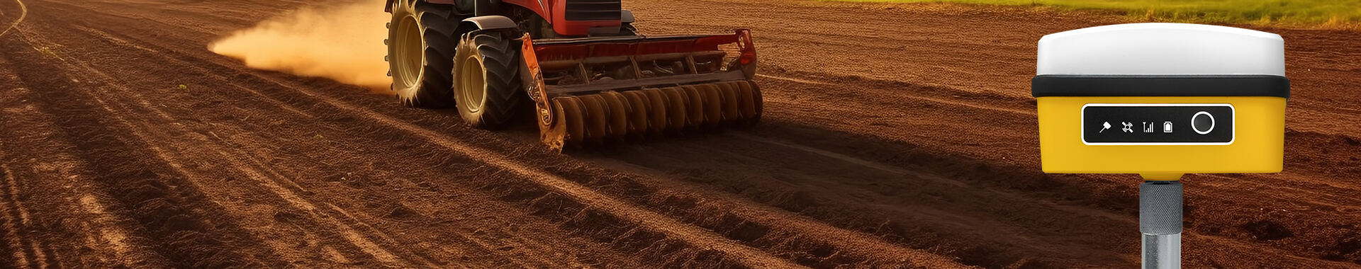
GNSS enhances the precision agriculture field by providing vital mapping data for effective land use and allocation. Specifically, the RTK satellite locator function enables farmers to maximize productivity by precisely identifying land boundaries and optimizing crop layouts. Purdue University's agricultural studies highlight that farms using RTK technology experience an average yield improvement of 12%, underscoring the technology's effectiveness. By utilizing RTK technology, farmers can make informed decisions regarding land use, ensuring optimal output and contributing to sustainable farming practices.
GNSS is instrumental in environmental monitoring and sustainable resource management by offering accurate data for tracking changes in ecosystems. It's used extensively in observing issues like deforestation, water levels, and urban sprawl, allowing both scientists and policymakers to respond quickly with data-driven solutions. Studies indicate that GNSS monitoring aids in reducing deforestation rates by 25% and helps manage urban sprawl effectively. The reliable information provided by GNSS supports sustainable practices, ensuring resources are managed responsibly, and helping mitigate environmental impacts through proactive measures.
GNSS surveying offers a significant advantage in real-time data collection over traditional methods. Unlike traditional surveying, which requires manual measurements and can take considerable time, GNSS systems provide instant data on-site, significantly enhancing efficiency. Field navigation tools integrated with GNSS systems further improve data accuracy. By utilizing real-time data, industries such as construction and agriculture can benefit immensely. For instance, in construction, precise data allows for accurate site assessments and planning, reducing errors and rework. Similarly, in agriculture, real-time data aids in monitoring crop growth and soil health, optimizing yield. The capability to collect and analyze data in real-time streamlines processes across these sectors, demonstrating the clear advantages of GNSS technology.
The use of GNSS for precision measurement brings notable cost efficiency to surveying projects. Precision measurement equipment minimizes the need for repeated site visits and manual interventions, leading to substantial time savings that directly translate into financial benefits. Various studies have shown that the upfront investment in GNSS technology results in considerable long-term savings and a high return on investment (ROI). By reducing errors and enhancing accuracy, GNSS systems allow for more streamlined operations, further lowering costs. These savings provide a compelling case for adopting GNSS technologies, especially for industries seeking to optimize budgets while maintaining high precision and accuracy in their projects.
The redevelopment of National Landing exemplifies how GNSS technology can transform urban spaces efficiently. GNSS played a pivotal role in modernizing infrastructure by streamlining surveys and navigational tasks, making the project a standout model of urban renewal. By utilizing advanced GNSS technology, engineers successfully mapped the area with precision, resulting in accurate real-time data collection, reducing project timelines and improving overall accuracy. The results were astonishing: enhanced data accuracy drove efficiency gains, reducing survey times by over 30%, thus cutting costs significantly. The project not only highlights the benefits of GNSS in urban renewal projects but also sets a benchmark for future endeavors.
Singapore's quest for becoming a Smart Nation is deeply intertwined with GNSS technology. The Singapore Land Authority’s initiative, SiReNT, has been revolutionary in integrating GNSS for urban planning and development. Founded in 2006, SiReNT expanded its number of GNSS-based reference stations over the years to support diverse applications, from environmental monitoring to autonomous vehicle navigation. GNSS has enabled Singapore to model a robust cadastral system, ensuring precise property boundaries and effective urban planning. This precision is evident in numerous metrics, like Singapore's improved navigational systems and enhanced urban living standards, which showcase the city's successful integration of GNSS in achieving smart city objectives.
Artificial Intelligence (AI) is revolutionizing the way we predict land use changes by leveraging GNSS data. By integrating AI algorithms with GNSS technology, we can enhance predictive land use models, which refine planning and management strategies. AI-driven data analysis allows for more accurate projections of urban sprawl, agricultural needs, and environmental impact by processing vast datasets efficiently, which were previously too cumbersome to analyze effectively. Looking ahead, the synergy between AI and GNSS technology is set to transform land management practices, making them more adaptive and efficient. This technological fusion holds promise for smarter cities where predictive insights drive sustainable growth and resource use.
RTK GPS technology is playing a pivotal role in climate resilience planning, offering advanced solutions for assessing and mitigating climate impacts. The advancements in RTK GPS have significantly improved precision measurement capabilities, making it an increasingly critical tool in climate adaptation projects. For instance, projects utilizing RTK GPS in watershed management and coastline protection have demonstrated greater efficiency in data collection and accuracy, enabling proactive climate responses. Statistical data indicates a growing reliance on RTK GPS technology in planning initiatives, with surveys and studies showing improved resource management and environmental adaptability. As climate resilience becomes ever more urgent, the integration of RTK GPS into strategic planning is expected to continue expanding, driven by the demand for robust, real-time data in navigating climate challenges.


 EN
EN AR
AR NL
NL FR
FR DE
DE HI
HI IT
IT JA
JA KO
KO PT
PT RO
RO RU
RU ES
ES SV
SV TL
TL IW
IW ID
ID VI
VI SQ
SQ TH
TH TR
TR MS
MS IS
IS HY
HY UR
UR BN
BN MN
MN