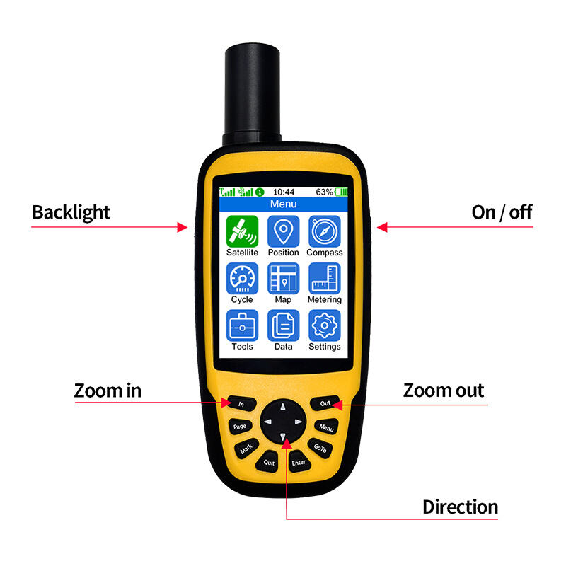
Portable RTK devices are revolutionizing the field of land surveying with their advanced technology and components. These devices typically consist of RTK receivers and base stations, working in harmony to provide precise positioning data. The RTK (Real-Time Kinematic) technology embedded in these devices enhances the precision and speed of land surveys, drastically reducing errors. This technology allows surveyors to achieve measurements with an accuracy margin of up to 1-2 centimeters.
The benefits of using portable RTK devices in surveying are numerous. Firstly, their compact and lightweight design offers increased mobility and flexibility on job sites, allowing surveyors to maneuver easily across difficult terrains. Secondly, these devices offer real-time data processing capabilities, which means data is accessible almost immediately for analysis and decision-making. This instant data retrieval reduces downtime and enhances efficiency in surveying operations. Portable RTK devices simplify workflows and deliver highly accurate data, making them indispensable tools in modern land surveying.
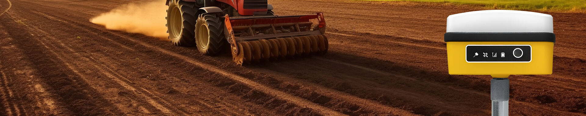
Portable RTK devices play a transformative role in precision agriculture, enhancing crop mapping and yield analysis. By offering real-time kinematic (RTK) GPS capabilities, these devices enable farmers to perform precise field operations. As a result, farmers can achieve up to 15-20% increases in efficiency through accurate planting, fertilization, and resource management. Moreover, RTK technology allows for continuous data collection and highly precise mapping, which is crucial for optimizing agricultural practices.
In construction and infrastructure projects, RTK devices are invaluable for site layout and monitoring. They provide accurate, centimeter-level position data that ensures the precise placement of structures and components. With RTK, construction managers can monitor processes in real-time, adjust plans quickly, and reduce costly errors, leading to more efficient project delivery. The ability to verify design parameters and as-built conditions using RTK technology minimizes delays and enhances communication across teams, facilitating smooth project execution.
Environmental monitoring also benefits significantly from RTK technology, aiding in the management of natural resources and conservation initiatives. RTK-equipped devices can map out resources accurately, track changes in ecosystems, and support conservation professionals in implementing strategies that protect biodiversity. The precision of RTK technology allows for effective monitoring of factors such as vegetation cover, water levels, and habitat boundaries, making it a powerful tool for environmental scientists and engineers working towards sustainable solutions.
The integration of portable RTK devices with mobile technology stands out as a significant trend. As smartphones and tablets become more powerful, they enable users to access and share RTK data remotely. This transformation is driven by the demand for connectivity and convenience, allowing professionals in various fields to pair mobile devices with external RTK receivers. Such integration enhances the capabilities of standard mobile gadgets, providing professionals with precise positional data without the need for bulky equipment.
Advancements in RTK GPS accuracy are noteworthy, with technologies like multi-frequency signals and satellite augmentation systems leading the charge. These innovations have propelled precision to new levels, making portable RTK devices increasingly reliable. Emphasized by the development of industrial-grade chipsets that were once reserved for high-end applications, such advancements bridge the gap between consumer and professional-grade equipment, broadening the usability of RTK technologies across different sectors.
Emerging features in RTK devices are redefining user interaction and expanding functionality. Developers are incorporating advanced user interfaces and machine learning capabilities into these devices. The inclusion of predictive analytics allows these sophisticated systems to offer deeper insights and more adaptable performance. By learning and predicting user needs, RTK devices can now offer tailored solutions, making them invaluable tools in sectors like agriculture, surveying, and construction.
When choosing portable RTK devices for land surveying, accuracy and precision are paramount concerns. Surveying projects demand varying levels of precision, and knowing the necessary benchmarks for acceptable tolerance levels is crucial. Generally, RTK systems capable of achieving centimeter-level accuracy are preferred. This precision ensures that even minute details in survey data are captured accurately, reducing errors in construction or mapping phases and ultimately minimizing costly rework.
Another factor to consider is the environmental and usability attributes of the RTK devices. Durability and waterproof ratings are essential if devices are to withstand diverse weather conditions. Additionally, portability should be prioritized, as surveyors often need to transport equipment across challenging terrains. Lightweight designs with robust build quality facilitate easier transport and setup, leading to more efficient operations on-site.
Finally, a cost versus benefit analysis is essential to understand the long-term value of high-quality RTK devices. While the initial costs may seem substantial, investing in reliable equipment can offer a significant ROI through enhanced efficiency and reduced labor costs. High-quality RTK systems, despite their price, offer sustained value by minimizing errors, reducing the need for repeated surveys, and streamlining the overall surveying process. Such investments can lead to greater productivity and substantial savings over time.
In the realm of portable RTK devices, the Cube RTK Small Volume High Precision Satellite Locator stands out as an exemplary compact solution. Designed for versatility, this device offers two operational modes—base station and measuring station. Equipped with features like a high-precision measurement satellite receiving antenna and an IMU tilt measurement module, it caters to both professional surveyors and enthusiasts seeking pinpoint accuracy. Its small size, combined with complete functionality, makes it ideal for those demanding high-precision positioning in challenging environments.
The 660 Dual Frequency RTK Handheld Measuring Instrument is another notable contender in the field. This handheld RTK device is packed with features that enhance agricultural applications, such as topographic surveying and field area measurement. With built-in 4G, WIFI, and Bluetooth capabilities, the device ensures robust connectivity and precise positioning accuracy down to 1cm. In comparison to market alternatives, the 660RTK offers comprehensive functionality for precision agriculture, supporting various satellite navigation systems like GPS, BeiDou, and Galileo.
Lastly, the Cube RTK Small Volume Full System stands out with its full-spectrum RTK capabilities. This device accommodates diverse surveying needs with features including built-in 4G, WIFI, dual-mode Bluetooth, and an anti-loss positioning function. Its capabilities make it a reliable partner for surveyors requiring both precision and flexibility in data handling and connectivity. The Cube RTK's storage and fast-charging battery further enhance its utility in challenging and remote locations, ensuring surveyors remain productive.
Innovations in portable RTK devices hold significant promise for the future of land surveying, with exciting advancements on the horizon. Key innovations include the integration of enhanced satellite connectivity and real-time updates, which can significantly improve the reliability and accuracy of RTK data. As these technologies evolve, surveyors can expect more robust and precise data collection experiences.
Artificial Intelligence (AI) is poised to further revolutionize RTK technology by automating data processing and enhancing analytical capabilities. Through AI algorithms, RTK devices can quickly analyze complex datasets, offering faster insights and facilitating more efficient decision-making processes in the field. This integration may lead to more autonomous surveying processes, reducing the need for manual intervention.
Technological advancements are shaping the future of surveying, driving a shift toward greater accuracy and multipurpose applications. As the capabilities of RTK devices expand, surveyors can increasingly tackle diverse challenges with a single device, adapting to various environments and requirements. This evolution promises to redefine traditional surveying, paving the way for innovative applications and methodologies.


 EN
EN AR
AR NL
NL FR
FR DE
DE HI
HI IT
IT JA
JA KO
KO PT
PT RO
RO RU
RU ES
ES SV
SV TL
TL IW
IW ID
ID VI
VI SQ
SQ TH
TH TR
TR MS
MS IS
IS HY
HY UR
UR BN
BN MN
MN