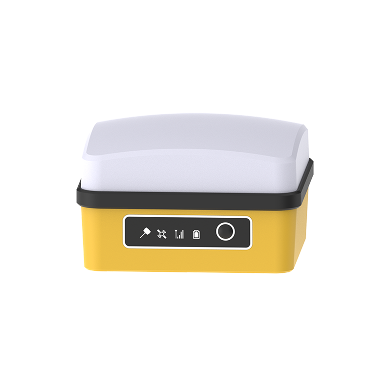
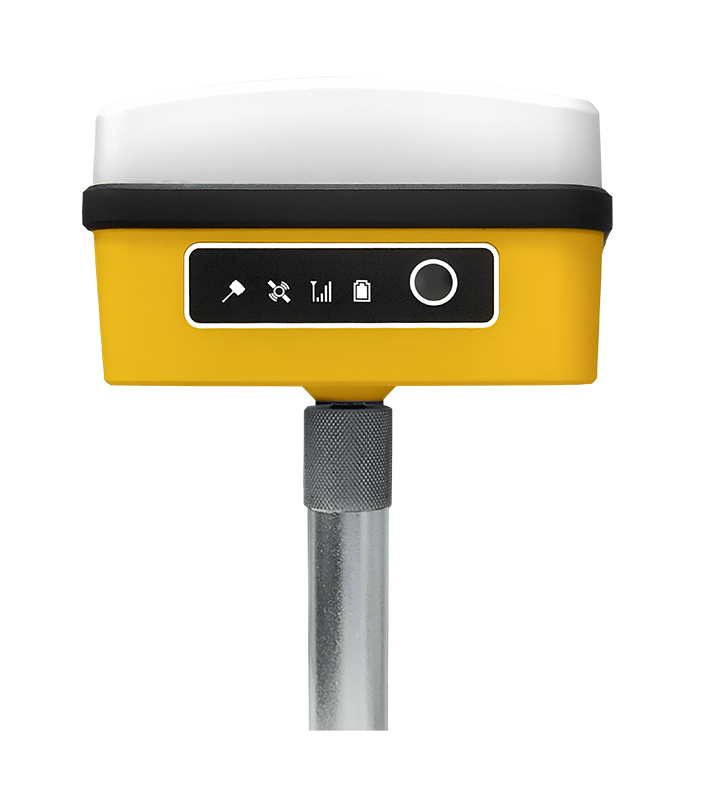
Maskura Technology is renowned for its high-quality GNSS equipment tailored for land surveying. Our product portfolio includes RTK receivers, antennas, and software, all designed to meet the demanding requirements of professional surveyors. We ensure reliable performance and precise results in every project.
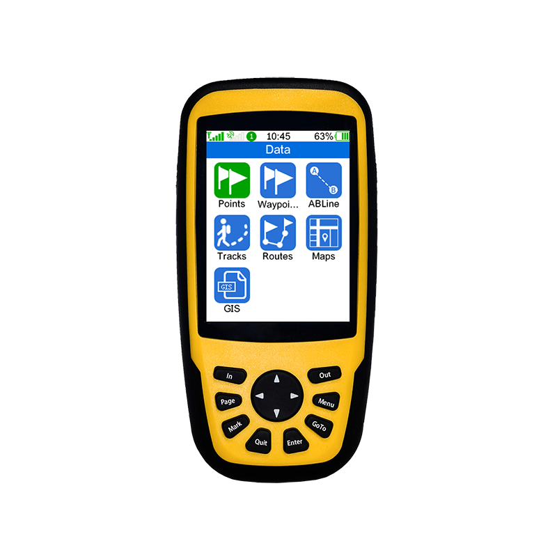
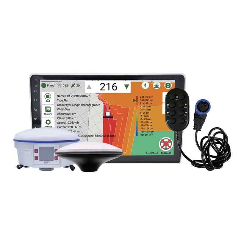
Maskura Technology develops advanced software solutions that enhance land surveying operations. Our software integrates seamlessly with RTK systems, providing surveyors with precise data and control. With a user-friendly interface and robust performance, we deliver tools that optimize surveying efficiency and improve productivity.

Maskura Technology is a leading manufacturer of high-tech GNSS surveying equipment. Our product range includes RTK receivers, antennas, software, and land levelers, all designed to meet the demanding requirements of land surveying. We deliver reliable solutions that optimize surveying operations and maximize efficiency.
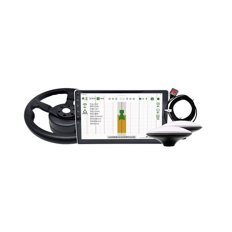
Maskura Technology leads the industry in providing precise land surveying solutions. Our advanced RTK systems ensure accurate and efficient surveying operations, making them ideal for professional applications. With a commitment to quality and innovation, we offer reliable tools that enhance productivity and accuracy.
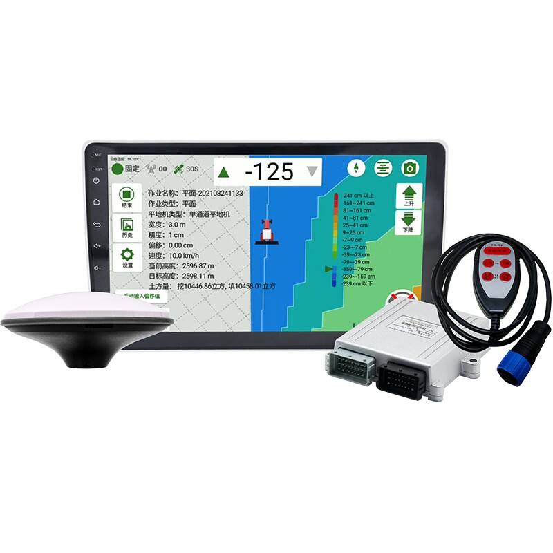
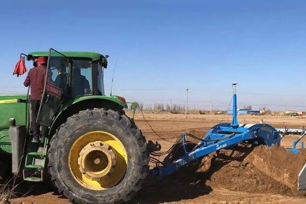
Maskura Technology's land levelers are equipped with precise GNSS technology for accurate land surveying. Our systems ensure optimal field preparation by providing reliable leveling and mapping capabilities. With a dedication to quality and performance, we deliver equipment that enhances surveying productivity.
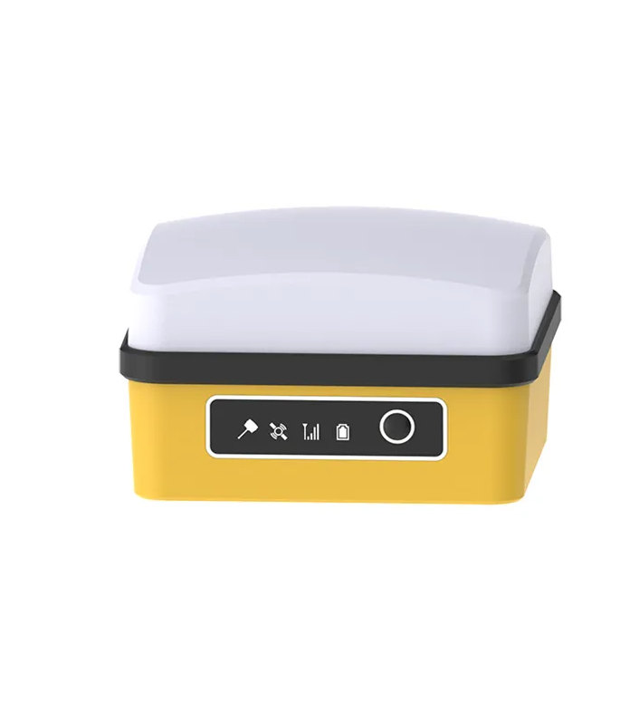
Shenzhen Maskura Technology, a renowned manufacturer of Hi-tech GNSS surveying equipment, has been at the forefront of innovation since its establishment in 2011. Specializing in a diverse range of products including RTK receivers, antennas, sophisticated software, land levelers, and autopilot systems, the company offers dependable and high-quality solutions to customers across the globe. With a focus on precision and accuracy, Maskura Technology's surveying equipment is trusted by professionals in various industries, ensuring accurate measurements and seamless operations. The company's commitment to excellence and continuous innovation has made it a leading choice for those seeking advanced surveying solutions.
Delivering cutting-edge technological advancements for diverse industries.
Ensuring superior product quality with rigorous testing and precision engineering.
Providing tailored solutions and excellent support to meet unique client needs.
Committed to meeting client needs with tailored solutions and exceptional support.
Maskura Technology stands out with our commitment to innovation and quality. We provide advanced RTK systems, GNSS technology, and land leveling solutions that enhance precision and efficiency in land surveying. Our products are designed to meet the highest standards of accuracy and reliability.
Our RTK systems offer exceptional accuracy for land leveling, field mapping, and surveying operations. By providing real-time kinematic data, surveyors can achieve precise and efficient results, optimizing resource usage and maximizing productivity.
We offer comprehensive maintenance and technical support services to ensure the longevity and optimal performance of our products. Our team is dedicated to assisting customers with any issues and providing regular updates to keep their equipment running smoothly.
We conduct rigorous testing and quality control processes on all our products. Our GNSS surveying equipment is built to withstand demanding field conditions, ensuring consistent and reliable performance in land surveying applications.
Maskura Technology provides advanced software solutions that integrate seamlessly with our RTK systems. These tools offer precise data analysis, field mapping capabilities, and user-friendly interfaces to enhance surveying operations and decision-making.
Our land levelers utilize precise GNSS technology to ensure optimal field preparation. By creating evenly leveled surfaces, surveyors can improve measurement accuracy, reduce errors, and enhance overall project efficiency, ultimately leading to better surveying outcomes.


 EN
EN AR
AR NL
NL FR
FR DE
DE HI
HI IT
IT JA
JA KO
KO PT
PT RO
RO RU
RU ES
ES SV
SV TL
TL IW
IW ID
ID VI
VI SQ
SQ TH
TH TR
TR MS
MS IS
IS HY
HY UR
UR BN
BN MN
MN